Create or find GPX track
Find a GPX on internet
Many websites will provide GPX track to download:
| Website | Email/Account required | Comment |
|---|---|---|
| https://www.visugpx.com | No 👍 | Many hikes |
| https://www.gr-infos.com | No 👍 | Best website to download GR GPX |
| https://www.openrunner.com | No 👍 | Some hikes |
| https://www.randogps.net | No 👍 | Some hikes |
| https://www.camptocamp.org | No 👍 | You can find some hiking route |
| https://www.visorando.com | Yes 😤 | Many hikes but Email required |
| https://www.komoot.fr | Yes 😤 | Many hikes but Account required |
Other websites:
| Website | Email/Account required | Comment |
|---|---|---|
| https://www.grenoblealpesmetropole.fr/860-parcours-de-trail.htm | No 👍 | Trail GPX |
| https://www.data.gouv.fr/fr/datasets/r/6404a8f4-e61f-4b79-93d1-e4bd71dedc26 | No 👍 | 269 GPX |
| https://fr-fr.gps-viewer.com | No 👍 | Can not sort by sport |
Create your own GPX track on a computer with GraphHopper
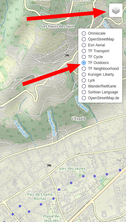
- Open GraphHooper
- On the top right angle, select the radio “TF Outdoors”
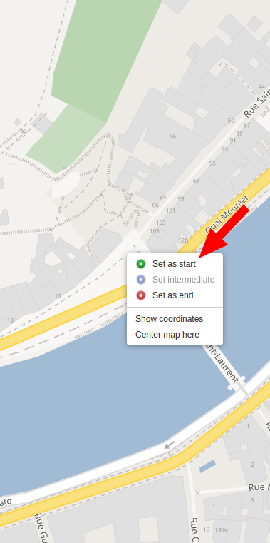
- Zoom the map until you see the start position of your new hike
- Right click on the map and select “Set as start”
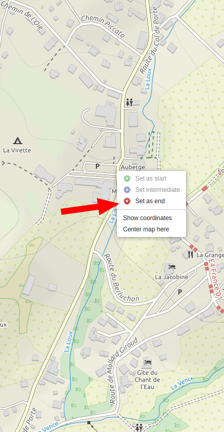
- Zoom the map until you see the end position of yout hike
- Right click until you see the end position of your hike
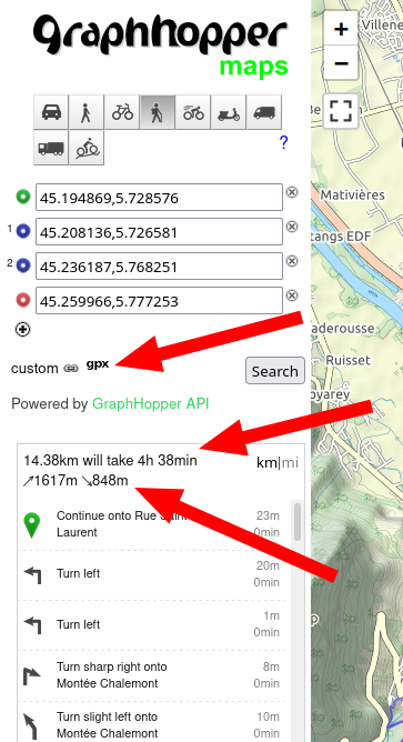
- Now click on the “hiker profile” on the left
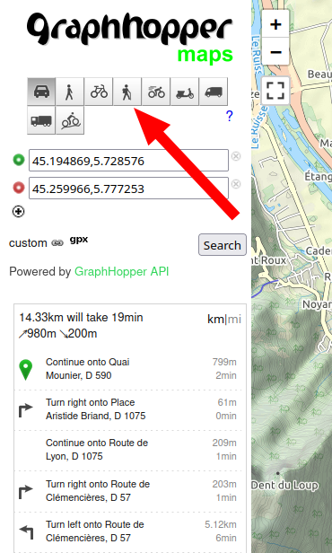
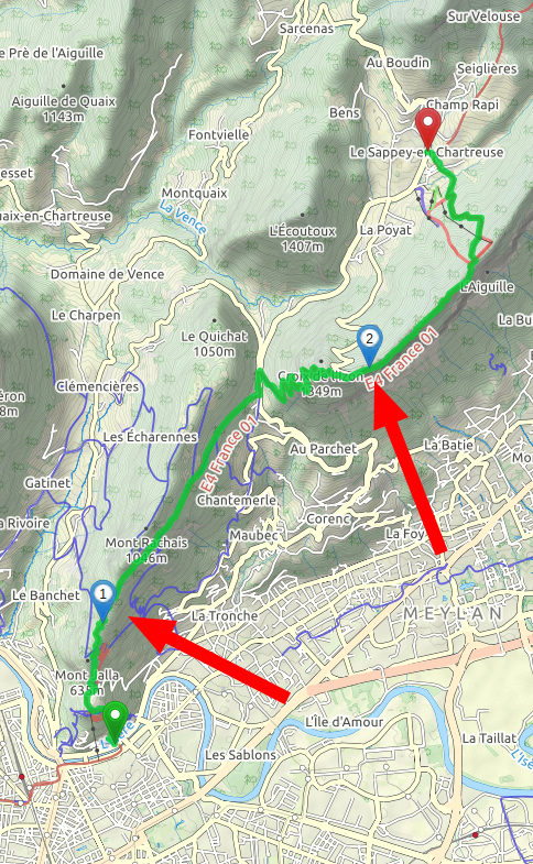
- GraphHopper will make a route for you:
- You can customize your route by adding steps
- To do so, right click on the map and select “Set intermediate”
- Now you have a “more friendly” hike
- You can see your hike detail (elevation, km) on the left
- And you can download the GPX track as well
- Done!