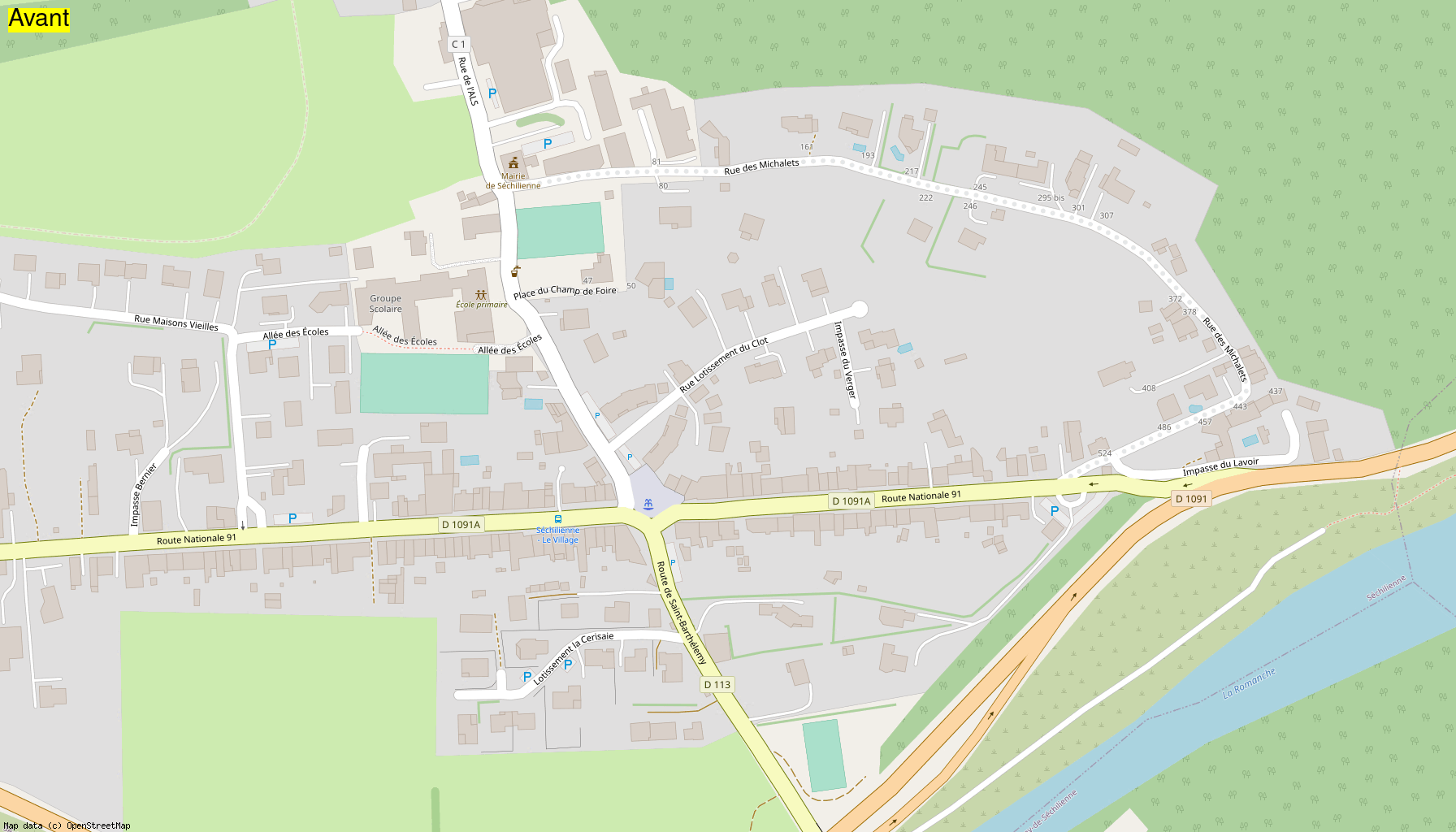
2023-09-23 Cartopartie Saint-Barthélemy-de-Sechilienne
Mapathon of September 23, 2023 at Saint-Barthélemy-de-Séchilienne:
- 🇫🇷 French version of this page
- Info on the mapathon
- Wikipedia page of the village
- Info on generating before/after gifs
Mapathon report
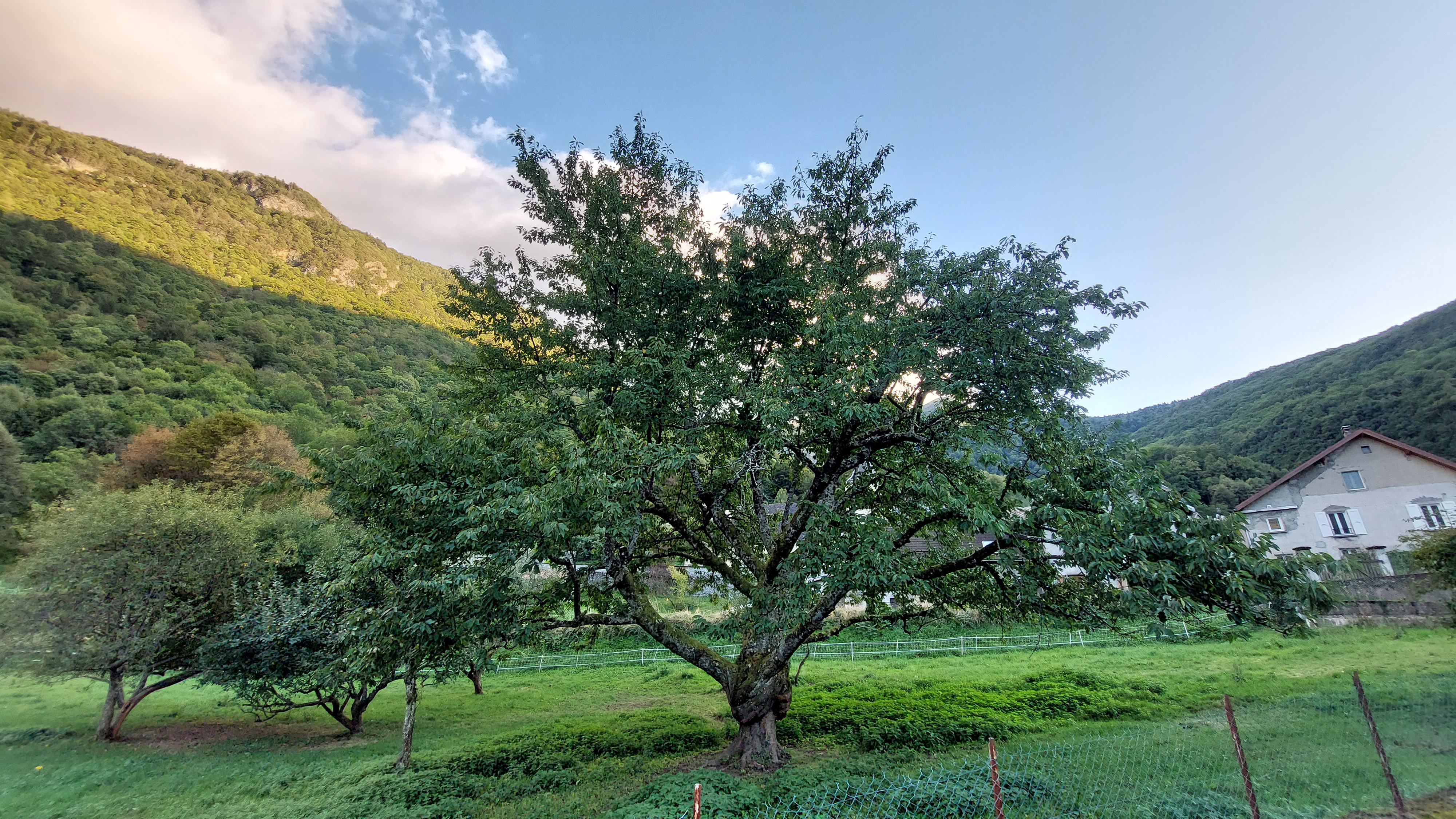
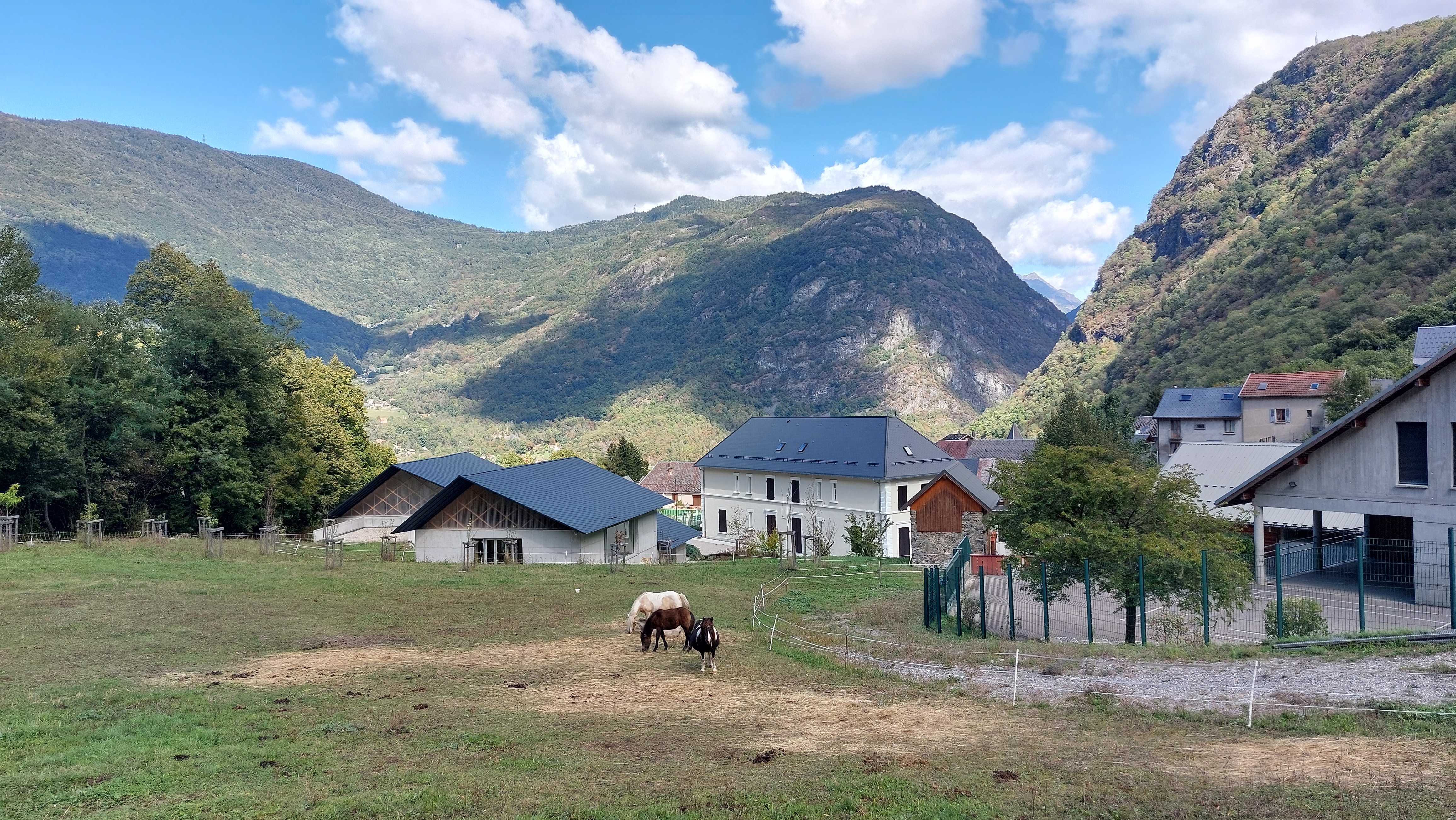
On this day of 23 September 2023, we were very warmly welcomed by the town hall staff and of course the mayor: Gilles Strappazzon. The mayor provided us with invaluable help by pointing out all the notables places in the village as well as all the hidden gems: fountains, wash houses, water channels and even a remarkable cherry tree:
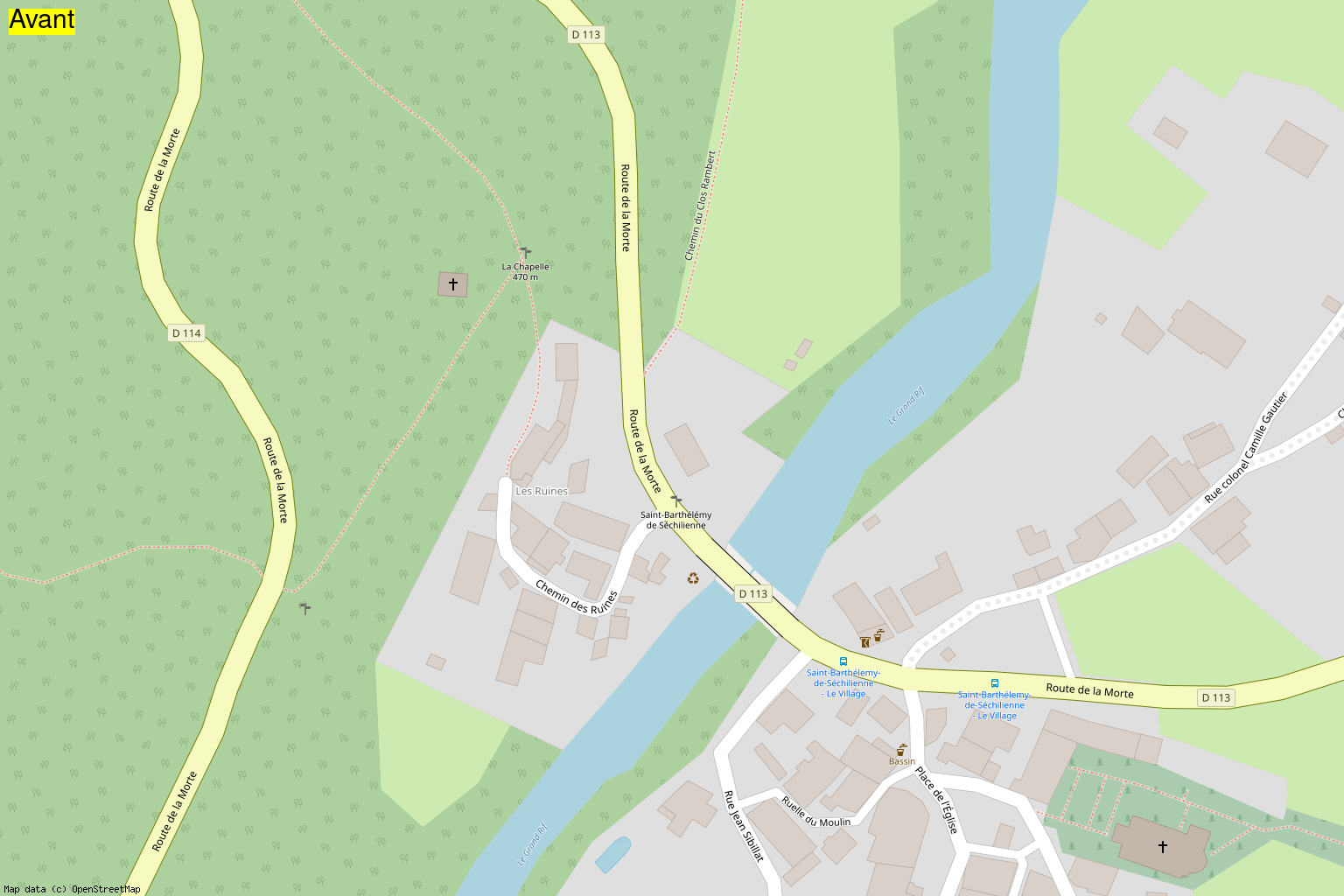
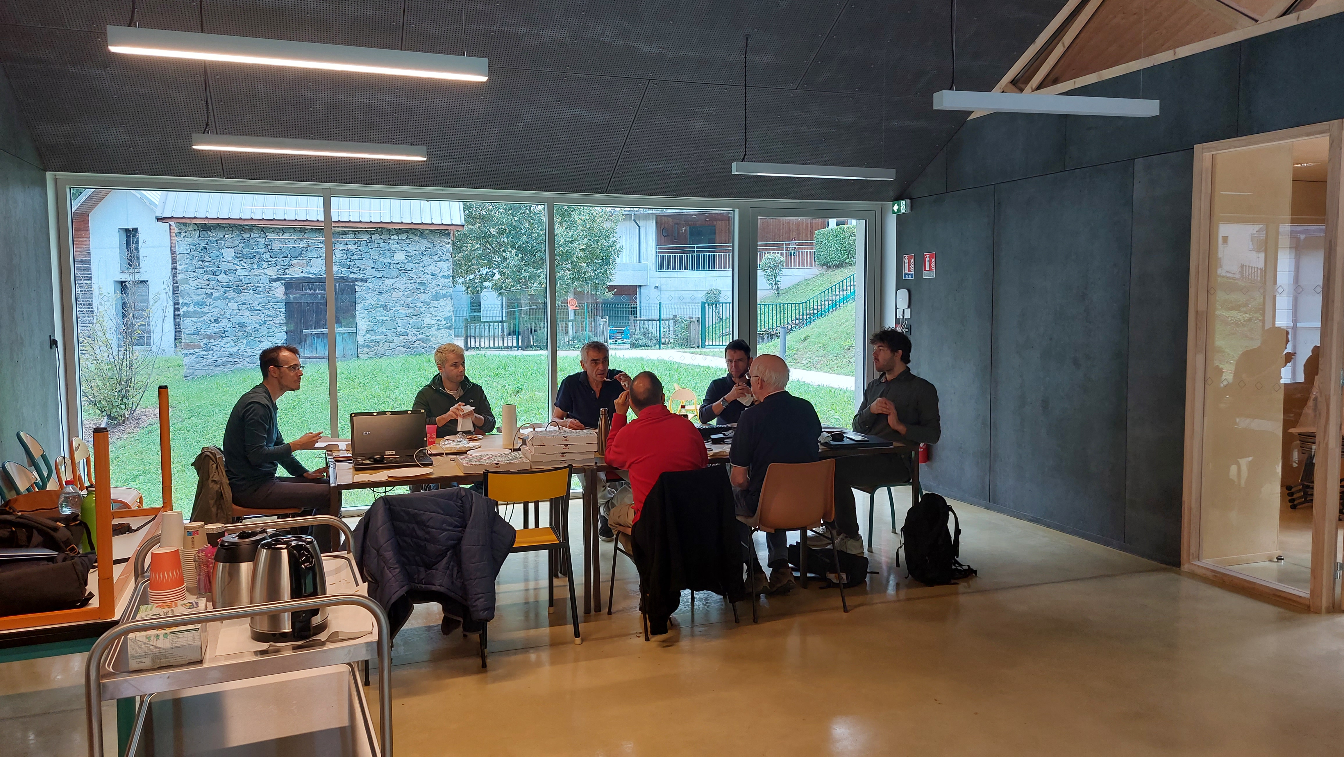
We were welcomed in one of the brand new rooms adjoining the new town hall. After a good coffee kindly offered by the town hall and pastries, we started to divide up certain areas to map. This is how Nicolas and I went to the place called “Les Ruines”, where we were able to visit the Chapel of Saint-François Régis:
| Exterior view | Interior view |
|---|---|
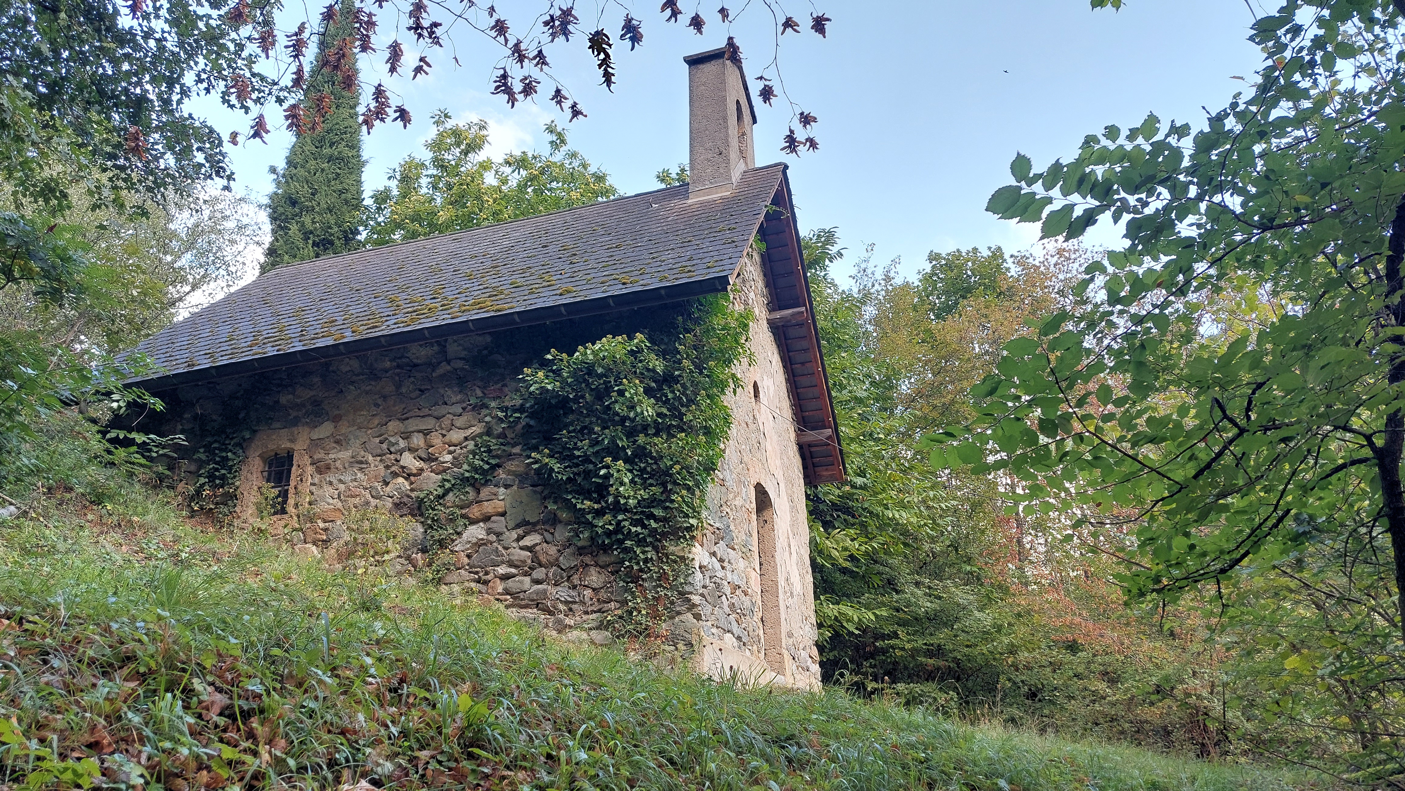 |
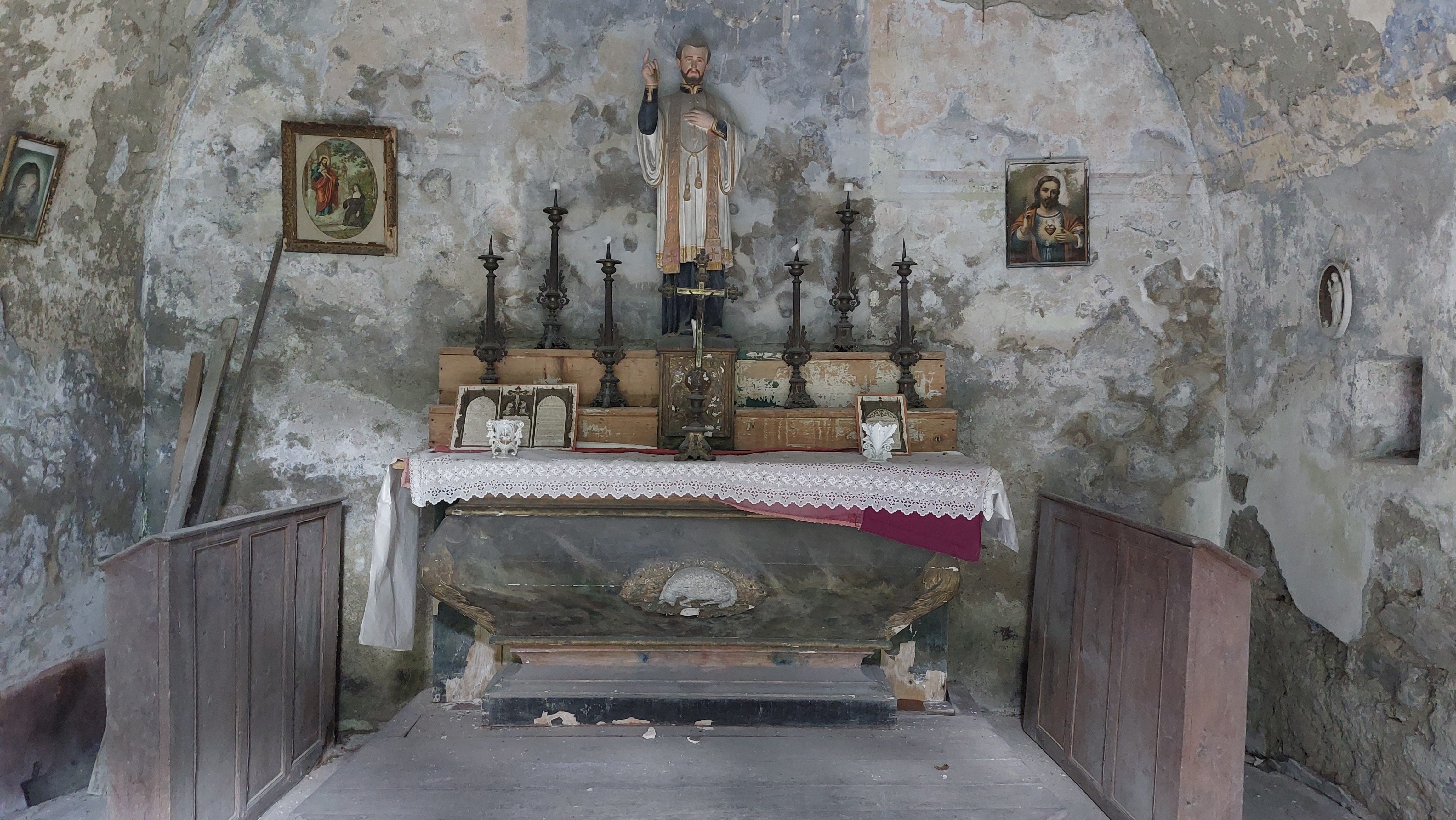 |
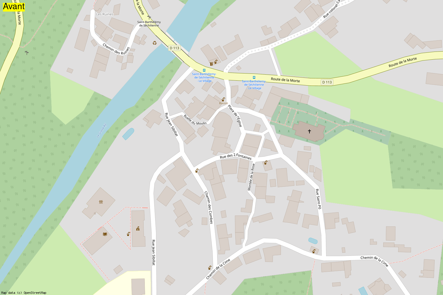
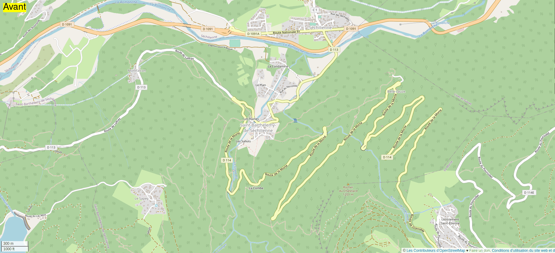
On site, we of course used the excellent mobile application Every Door to add all the POI found on site: hiking signs, recycling containers, etc. Here is an animation centered on “Les Ruines” neighborhood before/after the mapathon:
Subsequently, we dispatched a small car expedition in the town of Séchilienne. Objective: to map a bit of the area and go collect pizzas for our lunch break. We were 5 walking through the streets of Séchilienne, phone in hand to heat up Every Door, StreetComplete and Vespucci. We also recorded some GPS traces with OsmAnd to add a path between two neighborhoods of the city. Here is a comparison:
Once back in Saint-Barthélemy-de-Séchilienne, we used our GPS traces to drew this new path on iD. Just before the time to restore us:
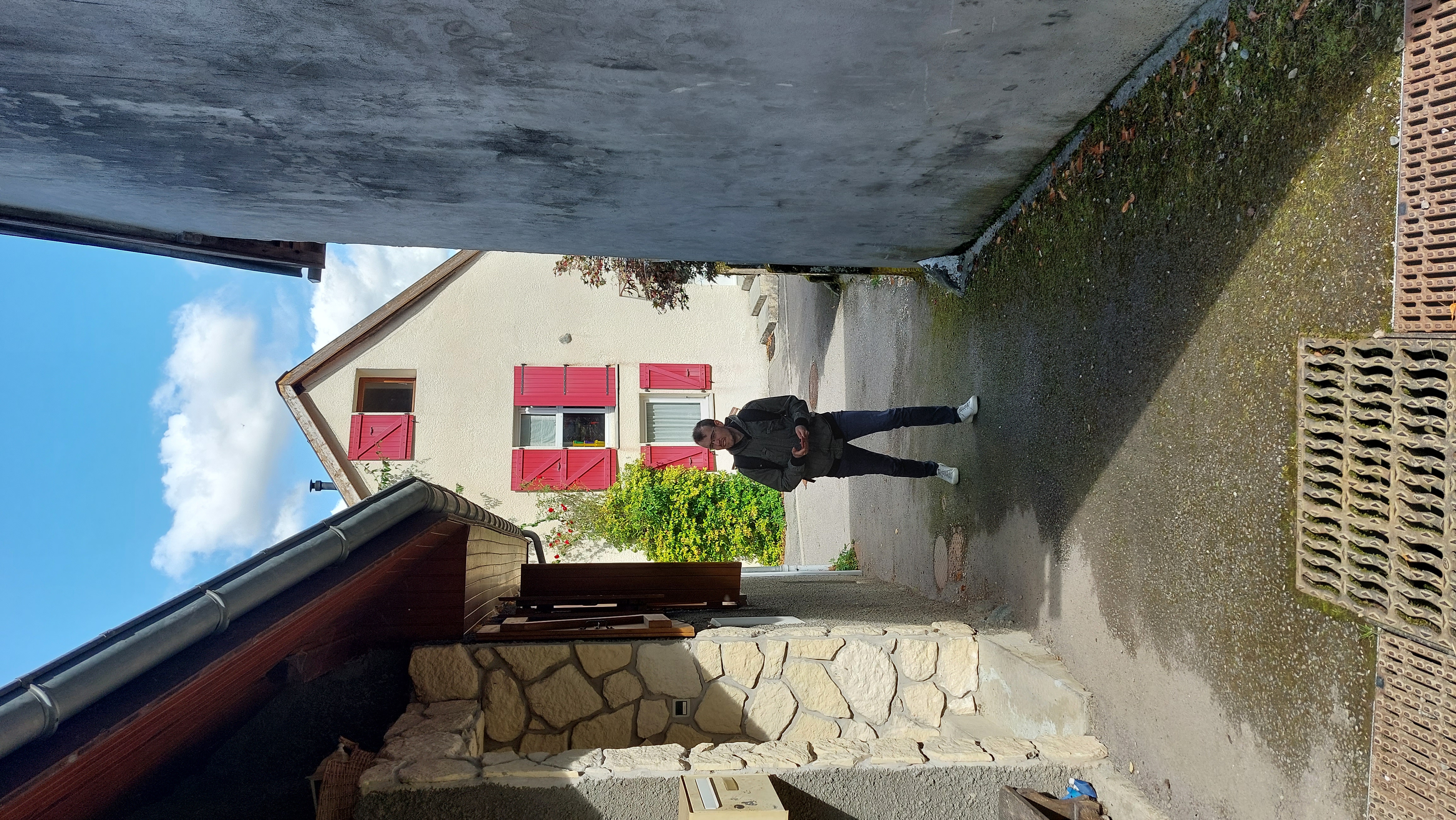
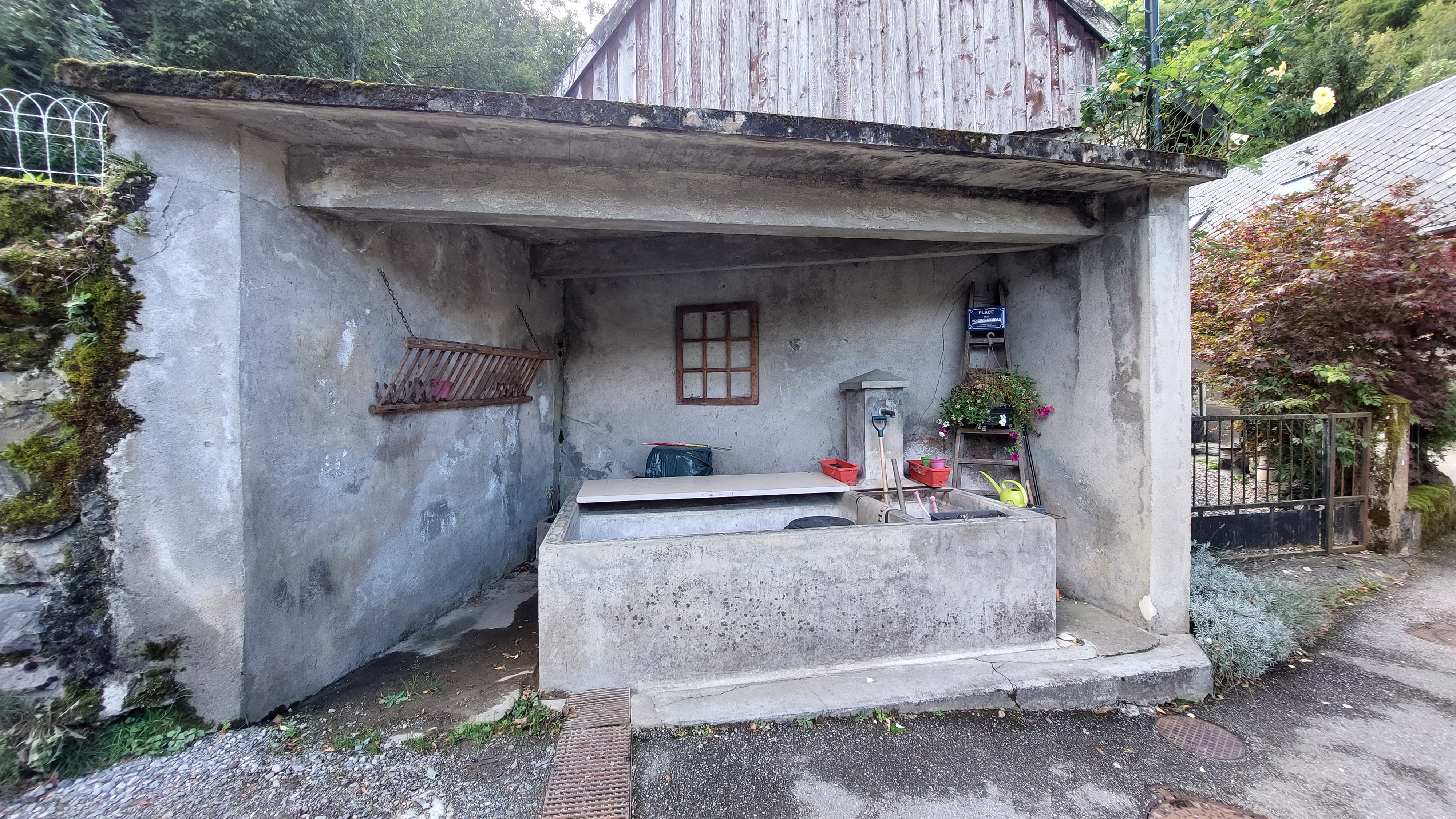
In the afternoon, I went back to explore Saint-Barthélemy with Nicolas, below are some photos of our adventures:
| Nico in action | A washing place |
|---|---|
 |
 |
A view of the village:
After, we navigated just about every corner of the village, phone in hand to add different POIs that came our way.
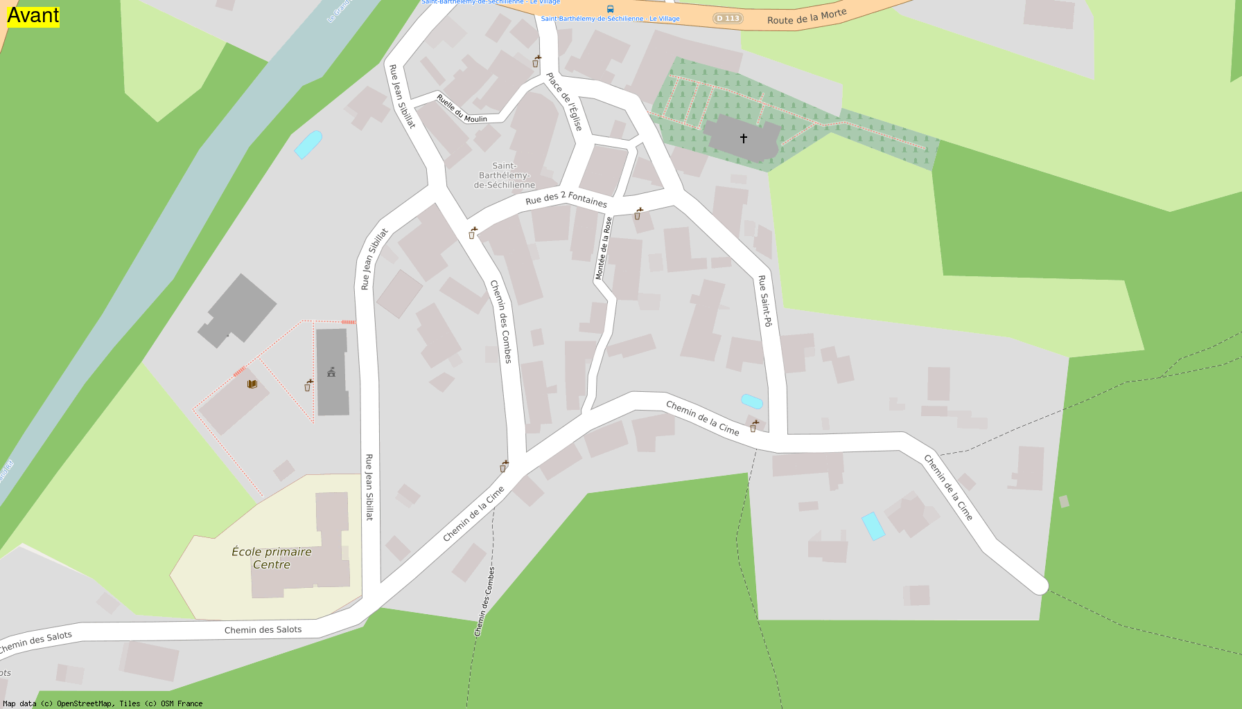
Animation on the village center:
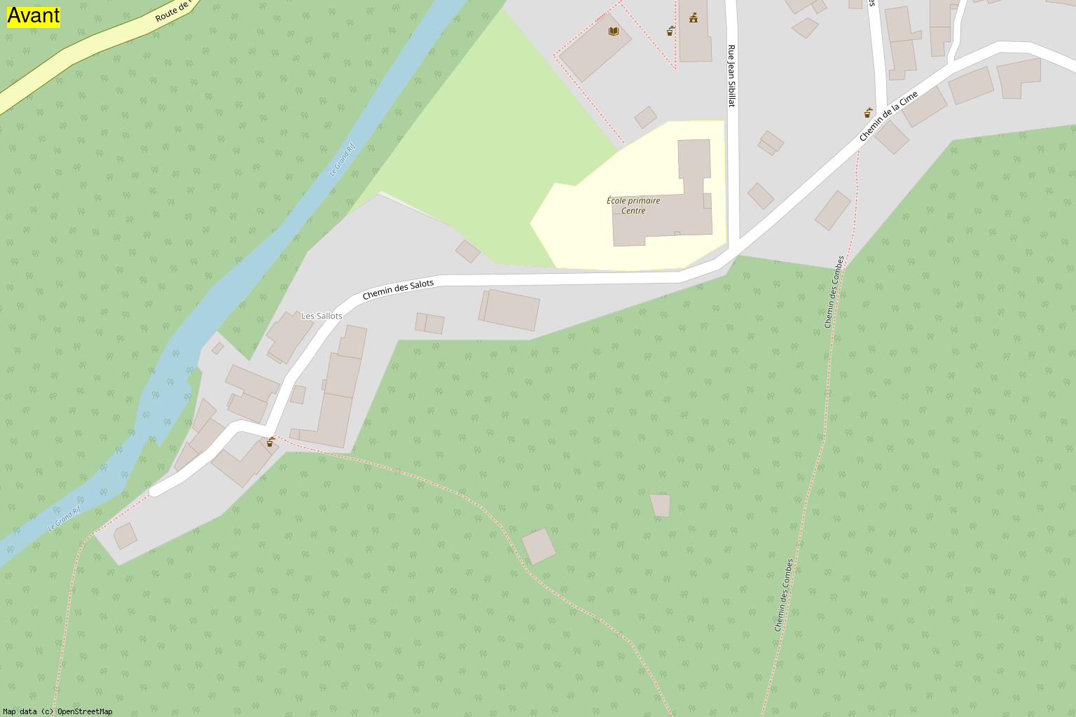
Animation near school:
Animation north of center:
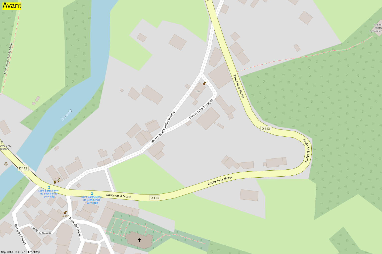
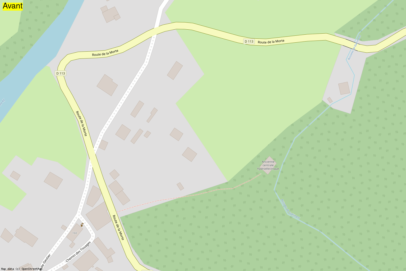
Towards the old hydroelectric power station:
Towards the Atticora carpentry:
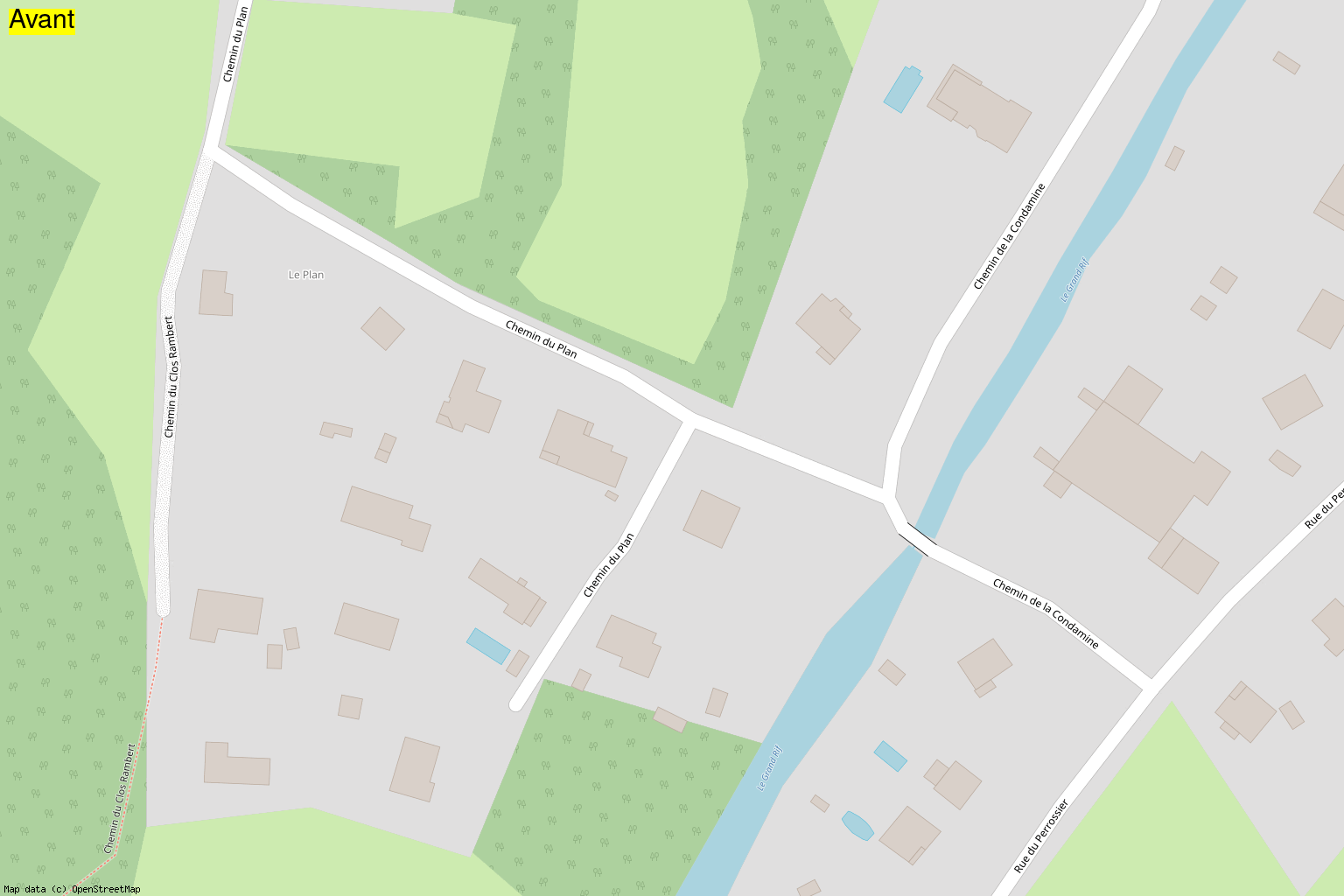
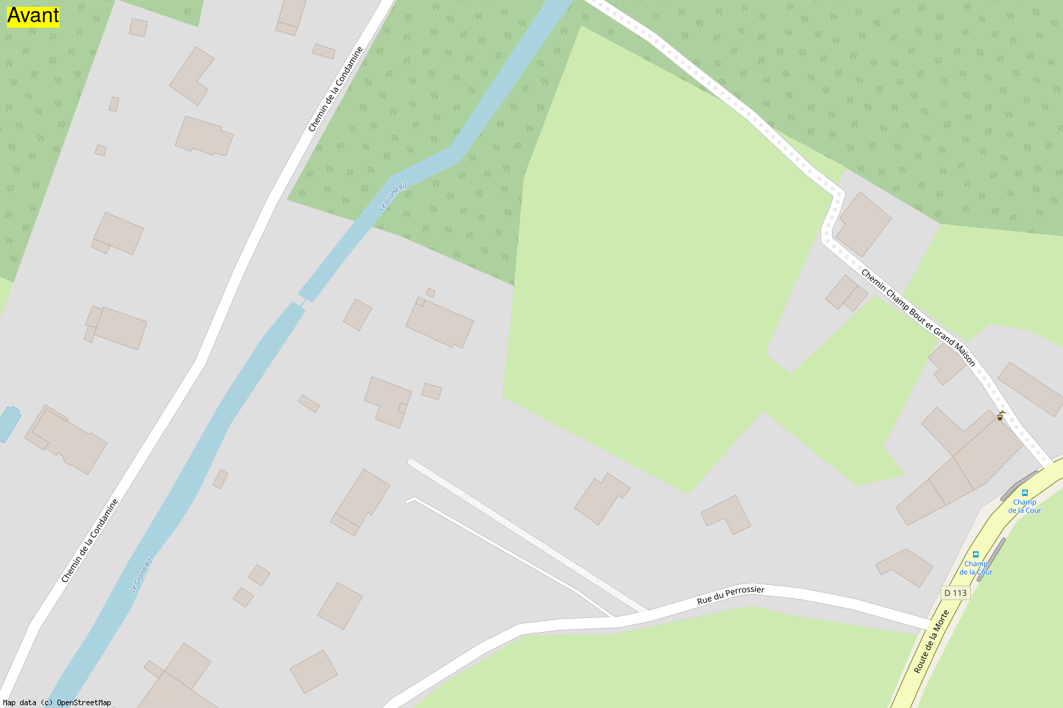
Towards Champ de la Cour:
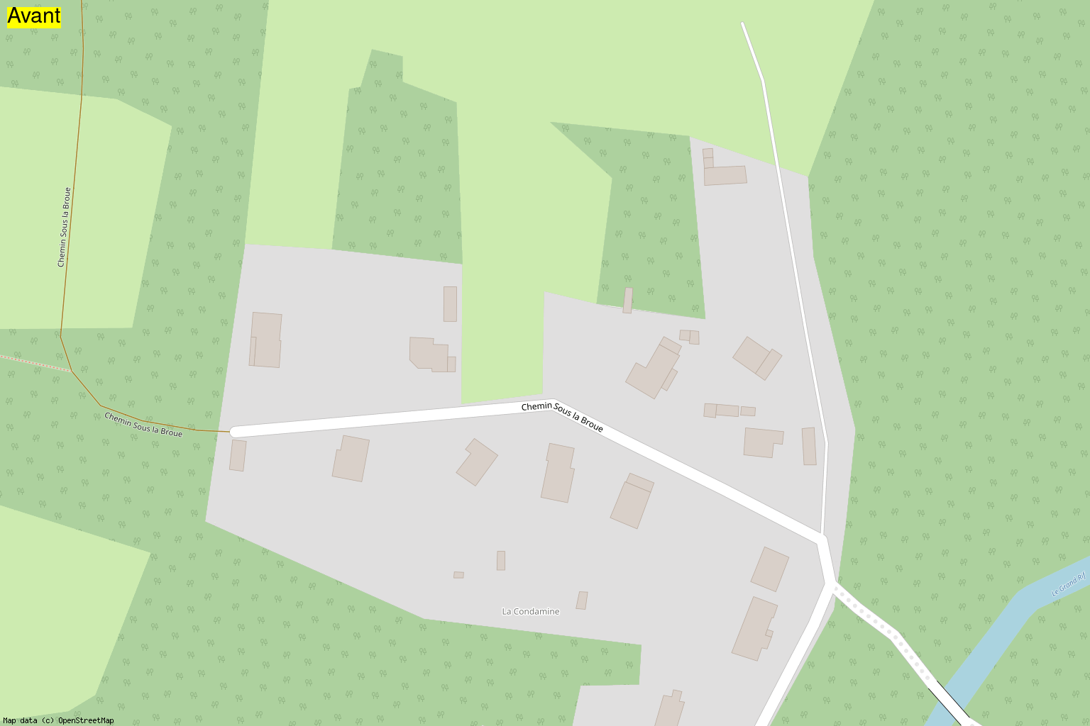
Path called “Chemin sous le Broue”:
Many other gifs are available on my GitHub repo. I also had fun using different map renderings.
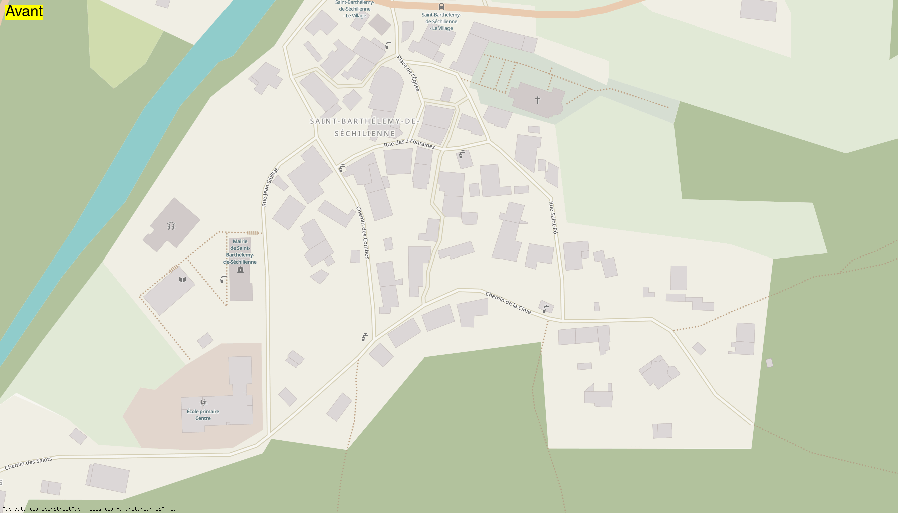
OSM France rendering:
“Humanitarian” rendering:
A point on statistics
During this mapathon, 193 roads (of all kinds) were added, including 46 tracks and 101 alleys, most of which are private driveways to access the various houses in the village.
On the house number side, we went from only 1 number listed to more than 257! A really good job made by one of us: chimel38.
Here are the detailed statistics that I generated via Osmosis:
| Objects | 2023-09-14 | 2023-09-23 | Added |
|---|---|---|---|
| Roads, tracks, etc. | 235 | 428 | 193 |
| Roads with name | 69 | 84 | 15 |
| Alleys | 9 | 110 | 101 |
| Tracks | 31 | 77 | 46 |
| Paths | 67 | 91 | 24 |
| Gates | 1 | 53 | 52 |
| Highway nodes (signs, pedestrian crossings) | 11 | 24 | 13 |
| Stop signs | 5 | 6 | 1 |
| Give way | 0 | 2 | 2 |
| Bus stops | 5 | 5 | 0 |
| Pedestrian crossing | 1 | 2 | 1 |
| Shops | 0 | 1 | 1 |
| Amenities | 21 | 48 | 27 |
| Parkings | 1 | 9 | 8 |
| Parking spaces | 0 | 1 | 1 |
| Parking nodes to convert to way | 0 | 0 | 0 |
| Bike parkings | 0 | 2 | 2 |
| Dedicated bike lanes | 6 | 6 | 0 |
| Bike lanes | 15 | 15 | 0 |
| Public bookcases | 0 | 0 | 0 |
| Libraries | 1 | 1 | 0 |
| Places (hamlets, village, …) | 17 | 17 | 0 |
| Buildings | 572 | 602 | 30 |
| Chapels | 1 | 3 | 2 |
| Churches | 1 | 1 | 0 |
| Shelters | 0 | 1 | 1 |
| Walls | 0 | 64 | 64 |
| Hedges | 0 | 87 | 87 |
| Street numbers | 1 | 257 | 256 |
| Memorials | 0 | 1 | 1 |
| Historical crosses | 0 | 1 | 1 |
| Religious crosses | 1 | 2 | 1 |
| Tourist objects | 19 | 37 | 18 |
| Drinking water points | 10 | 1 | -9 |
| Recycling containers | 1 | 3 | 2 |
| Schools | 1 | 1 | 0 |
| Yellow mailboxes | 1 | 1 | 0 |
| Fountains | 0 | 7 | 7 |
| Wash houses | 0 | 4 | 4 |
| Toilets | 0 | 1 | 1 |
| Objects with opening hours | 0 | 1 | 1 |
| Information signs | 0 | 2 | 2 |
| Benches | 0 | 6 | 6 |
| Streetlights | 0 | 9 | 9 |
| Pedestrian trash cans | 0 | 1 | 1 |
| Trash container | 0 | 1 | 1 |
| Viewpoints | 6 | 7 | 1 |
| Trees | 26 | 78 | 52 |
| Trees with genus | 0 | 15 | 15 |
| Rows of trees | 0 | 12 | 12 |
| Hiking/biking signs | 12 | 18 | 6 |
| Maps/plans | 1 | 1 | 0 |
| Picnic tables | 0 | 1 | 1 |
| Playgrounds | 0 | 0 | 0 |
| Sports fields/Equipment | 1 | 4 | 3 |
| Swimming pools | 8 | 36 | 28 |
| Fire hydrants | 0 | 13 | 13 |
| Craftsmen | 0 | 1 | 1 |
| Fixmes | 1 | 0 | -1 |
| Wikidata objects | 0 | 4 | 4 |
Curious people can turn to my cityStats.sh script in my GitHub repo.
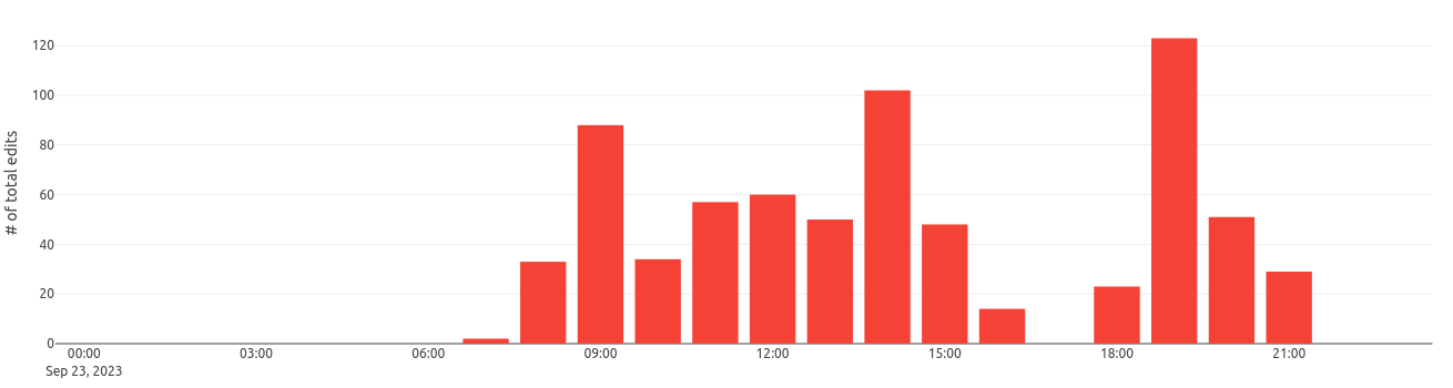
Here is a graph produced by ohsomeNow Stats showing our edits of the day, hour by hour for the hashtag #CartopartieSBDS:
Another graph with all the edits per day between July 27 and September 24:
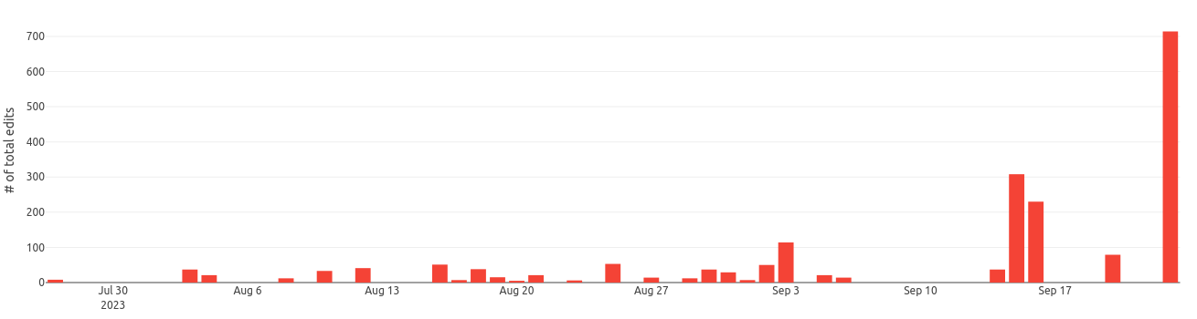
We can see that a lot of work was done before D-Day. For my part, I mapped a lot thanks to aerial imagery to add as many visible elements as possible: buildings, roads, hedges, walls, etc. I thought this preliminary work would make our task on the field easier and could bring up more quests on StreetComplete once on site.
Speaking of StreetComplete, I count more than 84 changesets made with StreetComplete. NB: StreetComplete does not allow (unless I’m mistaken) to add a hashtag to our contributions, so we will have to add these 84 changesets to our total.
The site resultmaps provides nice stats about the hashtag #CartopartieSBDS but only for the last 30 days. Here is the map of changesets traced by this tool:
| Centered on the village | Wider view |
|---|---|
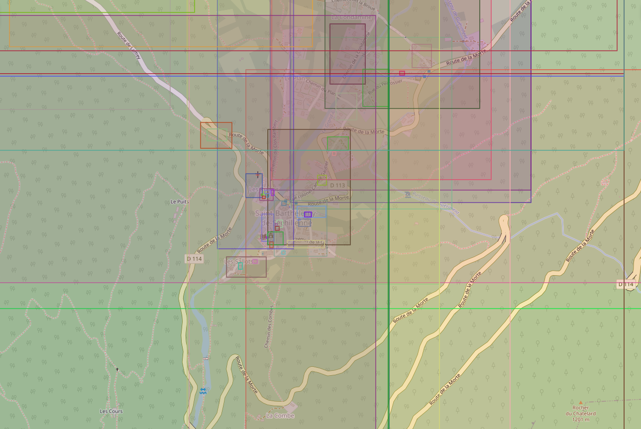 |
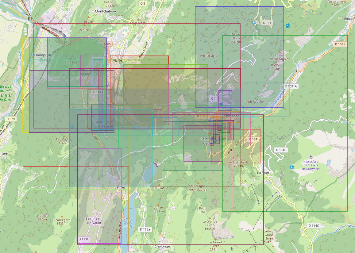 |
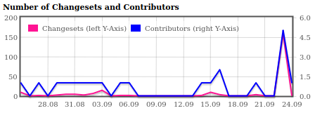
Graph of the number of changeset in pink (left y-axis) and the number of contributors (right y-axis):
Here is the information displayed by this tool for the tag #CartopartieSBDS:
- Number of OSM Contributors: 5
- Number of Map Changes: 6,214
- Total number of Changesets: 210
Number of created (modified) (deleted) OSM Objects
- Nodes: 3,855 (1,068) (297)
- Ways: 495 (483) (13)
- Highways: 230 (183)
- Buildings: 46
- Land-uses: 23
- Waterways: 7
We can see that this mapathon was particularly productive. With more than 6,214 map modifications! A very good score! Especially since we would have to add the modifications made by StreetComplete.
Conclusion
A beautiful day masterfully organized by Paul. Thanks to all the contributors present:
- barnes38 (alias Paul)
- NicolasGrosjean
- colargol
- chimel38
- ArnoPoit
- tetsuosp
- cyril_leblanc
- Binnette (myself)
Also thanks to Mr Mayor Gilles Strappazzon and the town hall staff for their warm welcome, valuable information, anecdotes and stories shared throughout the day.
Also thanks to OpenStreetMap France for the support for this event.
One last little animation showing more particularly the modifications of land-use:
Thank you for reading this report! Join us in person at one of our upcoming workshops in Grenoble, see the Agenda page of the local OSM Grenoble group. And if you too are interested in a mapathon in your city/village, talk to your elected officials/mayors and contact us by email via: contact-grenoble@listes.openstreetmap.fr